Methodology
The approach adopted and demonstrated on Bregava river catchment was to extract information relevant to rainfall–runoff
behaviours from remotely sensed observable catchment attributes. Application of deep learning helped to map
meteorological time series into streamflow that itself depends on a set of static catchment characteristics and dynamic
meteorological properties and results into an accurate flood forecast model. The proposed solution highly relies on EO
data inputs and derived products as Land Cover or vegetation characteristics and EO modelled meteorological variables.
Compared to other modelling approaches, the CV has many advantages with regard to fusing spatiotemporal data. This
project considered precipitation (P), temperature (T), and LAI data fields as the inputs of the data-driven models
resulting in flood forescast and runoff estimate.
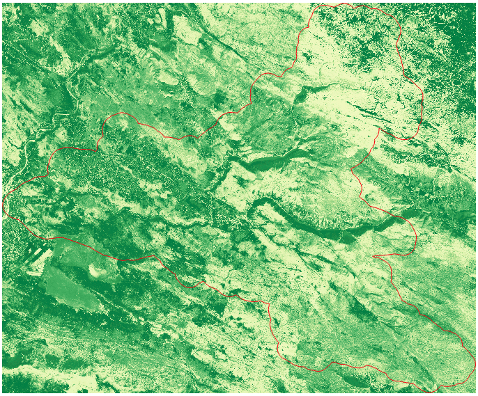
Example of Leaf area index derived from Sentinel 2 multispectral time series imagery during the main vegetation season
for the area of Bregava catchment (2018).
ERA5-Land data: precipitation estimate visualized as a timelapse for a selected period (spatial resolution 9x9 km,
temporal resolution – hourly).
(Bregava catchment, aprox. April 2018)